Locate the customer property
Enter the address from a lead or customer record. Confirm the property while OpenLawn loads the aerial and available parcel lines.
AI lawn measurement for the properties you service. Enter a customer’s address, review the mapped square footage, and use it to inform your next estimate.
5 free measurements. No credit card. Try it on your next lead.See the lawn you’re estimating, point by point. This real residential example maps grass around the house, deck, and trampoline—so those surfaces aren’t counted as lawn.
This saved result was adjusted by a user. It is an aerial estimate, not a surveyed measurement.
See how it works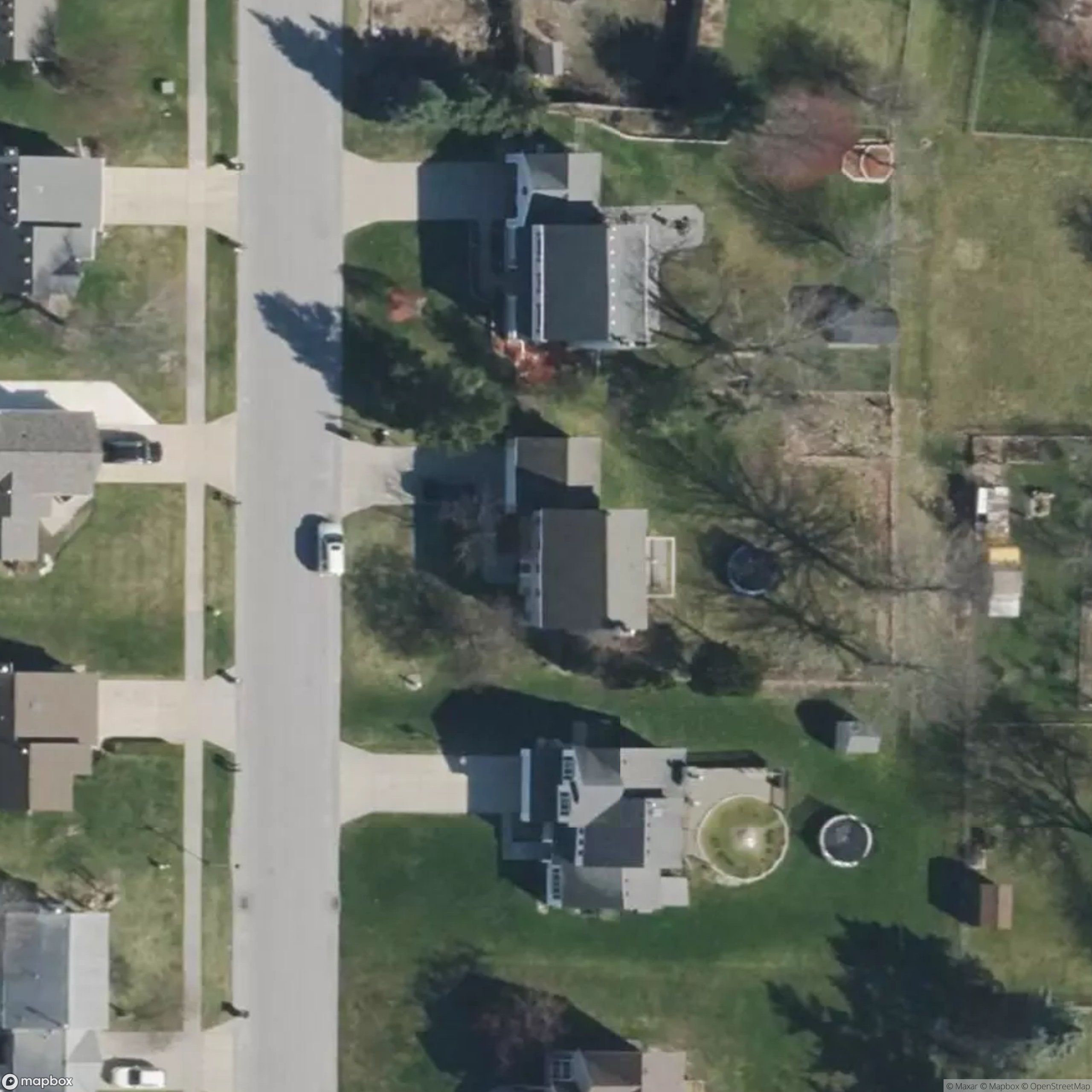
Accelerated replay of saved polygons, not a live measurement.
Enter the address from a lead or customer record. Confirm the property while OpenLawn loads the aerial and available parcel lines.
Watch the agent map visible lawn and exclude non-lawn surfaces. Review the square footage and correct any missed or extra areas.
Apply your own pricing and service requirements to the reviewed area. Reopen the saved property measurement when you need it again.
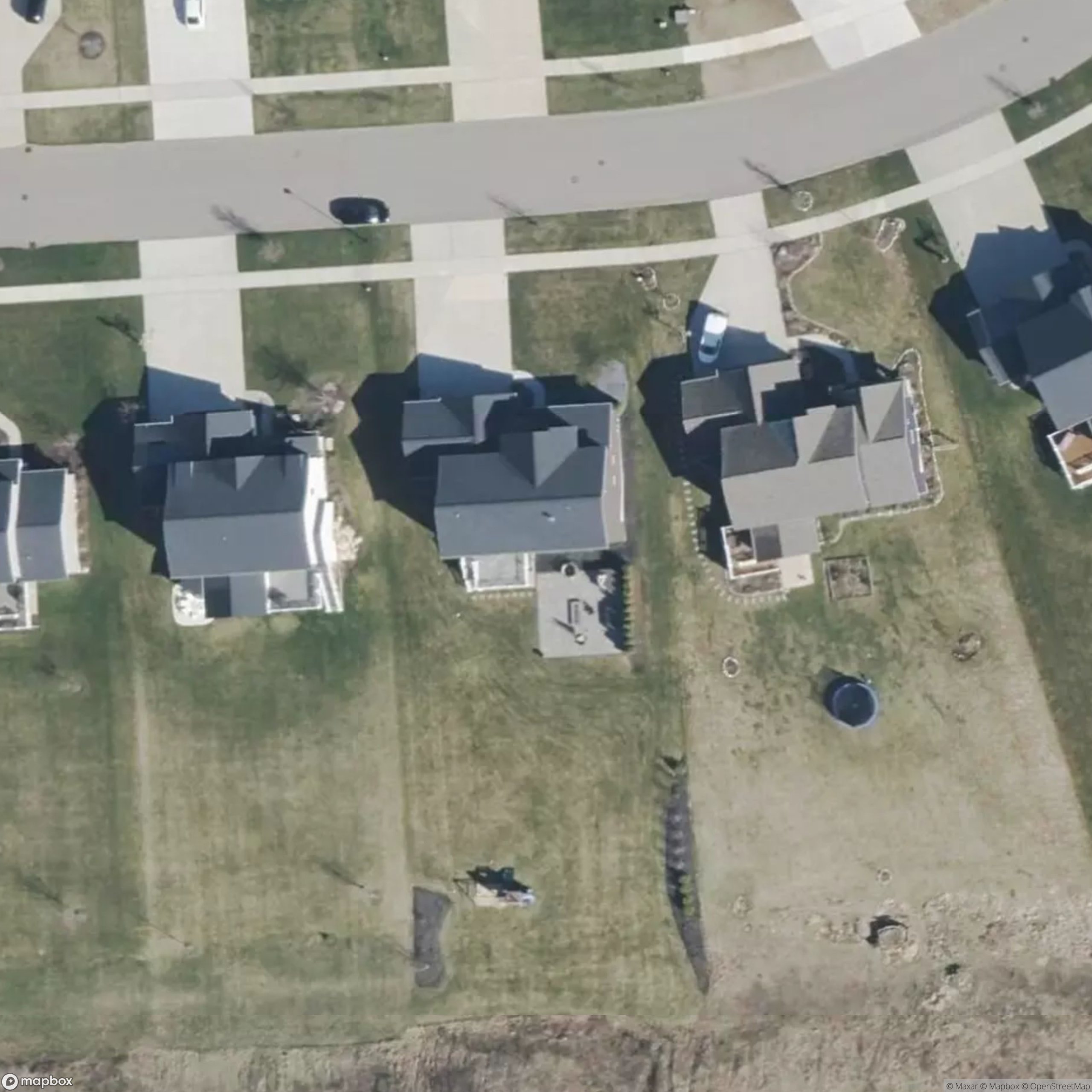
A lot-size number can include the roof, driveway, and patio. Review the actual lawn in your service scope, with available parcel lines for context and maintained grass outside the parcel identified separately.
An actual saved result, not guaranteed accuracy. Grass outside the parcel is an inferred service area—not a claim of ownership. Review every outline before using it.
Measure your next customer property →Estimate mowable turf from a customer address. Review the grass, exclusions, and maintained areas before applying your own pricing for mowing and lawn-care services.
Use reviewed lawn square footage as one input to outdoor pest-control estimates. Confirm the areas included in the service; lawn area is not the same as a building perimeter or every treatment surface.
Rate a result and correct its polygons when an edge is off. Reopen the measurement in your property history before the next estimate or service conversation. Shadows, trees, and older imagery can affect the result; an aerial estimate does not replace field verification or confirm a legal boundary.
Read the measurement guide for service estimates →Start with 5 free measurements. Monthly plans start at $39.00/month, with credits that never expire.
$39/ month
40 credits / month
$0.98 per included measurement
Get started$79/ month
100 credits / month
$0.79 per included measurement
Get started$179/ month
300 credits / month
$0.60 per included measurement
Get started$399/ month
800 credits / month
$0.50 per included measurement
Get started$2.40 per measurement
$1.60 per measurement
$0.80 per measurement
Credits that stay yours. Paid credits stack and never expire, even after cancellation. No automatic top-ups or overage charges.
All prices in USD. Cancel anytime; your subscription ends at the end of the paid billing period. Purchases are non-refundable except where required by law. Review your plan and total in checkout before paying.
Bulk enrichment plans with discounted volume pricing for teams measuring thousands of properties. Add AI-estimated lawn square footage to your customer or prospect records through the OpenLawn API.
Custom quotes based on record volume and workflow. Tell us how many properties you need to measure and how often.
Give your AI agent a new skill: measure a customer’s lawn, review the mapped area, and bring back the square footage. Built for lawn care and pest control teams.
Copy the prompt, paste it into your agent, and review its installation steps.
Local install · No measurement credits used
Codex skill documentation ↗~/.agents/skills/openlawn-measureBrowser control + an OpenLawn account required. The skill provides instructions, not browser tools. These prompts target local agents, not regular ChatGPT, Claude, or Gemini chats. Tool availability depends on your setup.
Replace the placeholder with your customer’s property. Sign in to OpenLawn yourself when prompted.
Use the OpenLawn skill to measure the lawn at [full U.S. street address, city, state]. Return the estimated lawn square footage, available parcel and verge details, and any caveats. Let me sign in myself if needed.
Agent marks via LobeHub Icons (MIT). Trademarks belong to their owners. No endorsement implied.
Which models draw the lawn best? One simple score shows how closely each matched a reviewed lawn outline.
 GPT-6 AstraOpenAI
 Gemini 3.1 Pro Preview*Google
 Claude Opus 5Anthropic
 Seed 1.8ByteDanceGPT-5.6 TerraOpenAIClaude Sonnet 5Anthropic
Swipe to compare all six scored models →
Scores reflect outline agreement on one user-corrected property, not surveyed accuracy or a guarantee. *Gemini Pro used a larger output budget.
Astra and Gemini Pro scored similarly in this small test. Astra completed maps sooner under its tested settings, so it remains our current choice. Every measurement still benefits from a quick human review.
9 models tested · 3 residential properties · 41 attempts · 25 completed
The quality index is mean polygon overlap with the corrected outline, expressed on a 0–100 scale. It measures shape agreement only—not speed, reliability, or real-world accuracy. An 82.9 score does not mean 82.9% measurement accuracy. This internal study was run by OpenLawn and has not been independently audited.
Astra and Opus include both their initial and repeat reference runs. Other scored models have one reference run. Astra ranged from 75.2 to 90.7; Opus from 75.1 to 76.2. These observed ranges are not a confidence interval. Different settings and unequal repeat counts limit comparisons.
Each model received the same saved aerial, parcel, mapping prompt, drawing tools, parser, and area calculation. Corrected polygons were withheld; no SegFormer hints were used. The prompt was developed for Astra. The initial configuration used medium reasoning and 2,400 output tokens per turn. Gemini Pro's scored configuration used 8,192 tokens; its initial configuration did not finish. Astra low-reasoning runs are kept in the full results, not mixed into this chart.
Astra's initial mean model-pipeline time was 46.4 seconds; Gemini Pro's adjusted mean was 123.9 seconds. These timings exclude address lookup, queueing, browser rendering, and saving. Provider load and cache warmth were not controlled.
Claude Fable 5.1Gemini 3.8 Flash Grok 4.6
Fable, Gemini Flash, and Grok did not complete a scored reference run in the tested configurations. This is missing evidence, not a zero quality score. Failures, compatibility retries, and all repeat runs remain in the download. Only one property has a corrected reference, and none have surveyed ground truth. Inputs and full artifacts are not public, so this is not a fully reproducible public evaluation.
Read the complete methodology and configuration results ↗
Provider marks via LobeHub Icons (MIT license). Names and logos belong to their owners; no endorsement or partnership is implied.
OpenLawn is AI lawn measurement software for lawn care and pest control businesses. Enter a customer property address, review mapped lawn square footage, and save the measurement to support estimating and service planning.
OpenLawn is built primarily for lawn care and pest control businesses that need lawn-area estimates for customer properties. Owners, estimators, and service teams can review the mapped area before using it to inform their own quotes and service plans.
Create an OpenLawn account, enter the customer property address, and select the right match. The agent loads the aerial and available parcel boundary, then outlines lawn regions and calculates an estimate. Review the mapped areas and confirm the intended service scope before using the result.
No. Lot size includes the house, driveway, sidewalks, patios, beds, and other surfaces. OpenLawn maps grass rather than treating the entire parcel as lawn. Street-side service grass and inferred maintained extensions may be outside the parcel and should be reviewed separately.
Accuracy depends on image resolution and age, shadows, tree cover, address placement, and parcel alignment. OpenLawn provides a reviewable estimate, not a guaranteed accuracy percentage. Check the overlay and verify important measurements on site. Our published model benchmark is a small internal comparison, not independently surveyed accuracy.
OpenLawn accepts U.S. and Canadian addresses. Our parcel dataset covers the United States; Canadian measurements use visible property features where parcel data is unavailable. Aerial detail varies by location. An inferred working outline is an estimate, not a verified property line.
Every new account receives five free AI lawn measurements, with no credit card required. The allowance is shared across that account’s devices and workspaces. A completed AI analysis uses one measurement; model failures return the reserved credit. Reopening saved results does not use a measurement.
Yes. Use reviewed lawn square footage as an input to mowing and lawn-care estimates, then apply your own pricing. Check exclusions, access, slopes, obstructions, and service requirements separately. OpenLawn measures lawn area; it does not calculate the final quote for you.
Yes. Pest control teams can use reviewed lawn square footage as one input when estimating outdoor services. The current workflow maps lawn, not building perimeter length or every possible treatment surface. It does not identify pest activity, recommend products, calculate application rates, or generate treatment plans.
Yes. Review and rate the completed measurement. If areas were missed or included incorrectly, use the polygon correction controls to adjust the mapped lawn and review the revised estimate.
Agent View uses GPT-6.1 Sol by default for lawn mapping. After a completed Sol measurement, you can remeasure the same property with GPT-6 Astra using another measurement credit and compare the saved results. Both models combine aerial imagery with available parcel context and draw reviewable lawn polygons. Model output is an estimate.
Yes. Install the OpenLawn skill in an agent that supports SKILL.md instructions and browser control. It guides the agent through the signed-in address-to-measurement workflow and reading saved results. It uses your OpenLawn account and the same measurement allowance.
Try 5 free measurements on customer properties. Review the lawn, check the scope, and keep the result for the next conversation.
Start measuring for my business →